


By Kristine Lowder
 There’s no apostrophe in “Johns River” or “Johns River Dike Trail.” That’s not a punctuation error, according to local resident John Meyer. “Cartography in those days didn’t have possessives,” explains Meyer, who is also a member of the Pacific County Historical Society.
While apostrophes may be missing from this quiet, secluded site, a rich and colorful history is not. According to the Department of Fish and Wildlife, which manages the area, Johns River Wildlife Area covers more than 6,700 acres, managed in 15 units located near the Pacific Coast on the Olympic Peninsula. The local portion is 12 miles southwest of Aberdeen off Highway 105.
Located just past the Ocean Spray cranberry plant, the storied site includes two access sites nestled between Markham and Ocosta. While the modern day Johns River area offers choice recreational and wildlife viewing opportunities in a scenic, serene setting, its back story includes pioneer history dating back to the 1880s, a cemetery and monument, the first white child born on the Harbor, and cattle.
According to Meyer, who lives on the river, “Johns River” was named after John Hole, “the first white man to live in the area.” Hole is said to have arrived in the area in 1850 or 1852. John Hole built a cabin on the river that now bears his name. He was later joined by pioneer Patterson Fletcher Luark, originally from Tennessee. On November 6, 1858, Luark’s wife, Mary, gave birth to the “first white child born on the Harbor.” The baby was named Robert Gray Luark.
Patterson Luark was among the first to run cattle in the area. If you look sharp, you can still see signs of that past.
“As you go into the area off Highway 105, on the right hand side, there’s a big ditch,” explains Meyer. “They put some jersey barriers along the ditch. That used to be a cattle path where cattle would go from one side of the road to another. It was required when they put in a plank road, back when Ocean Spray was just a pup. In order for the road to go through, they had to have an underpass so cattle could go from one side of the road to another without getting hit by a Model T or a buggy,” he laughs.
Another “first” for the area is its old cemetery.
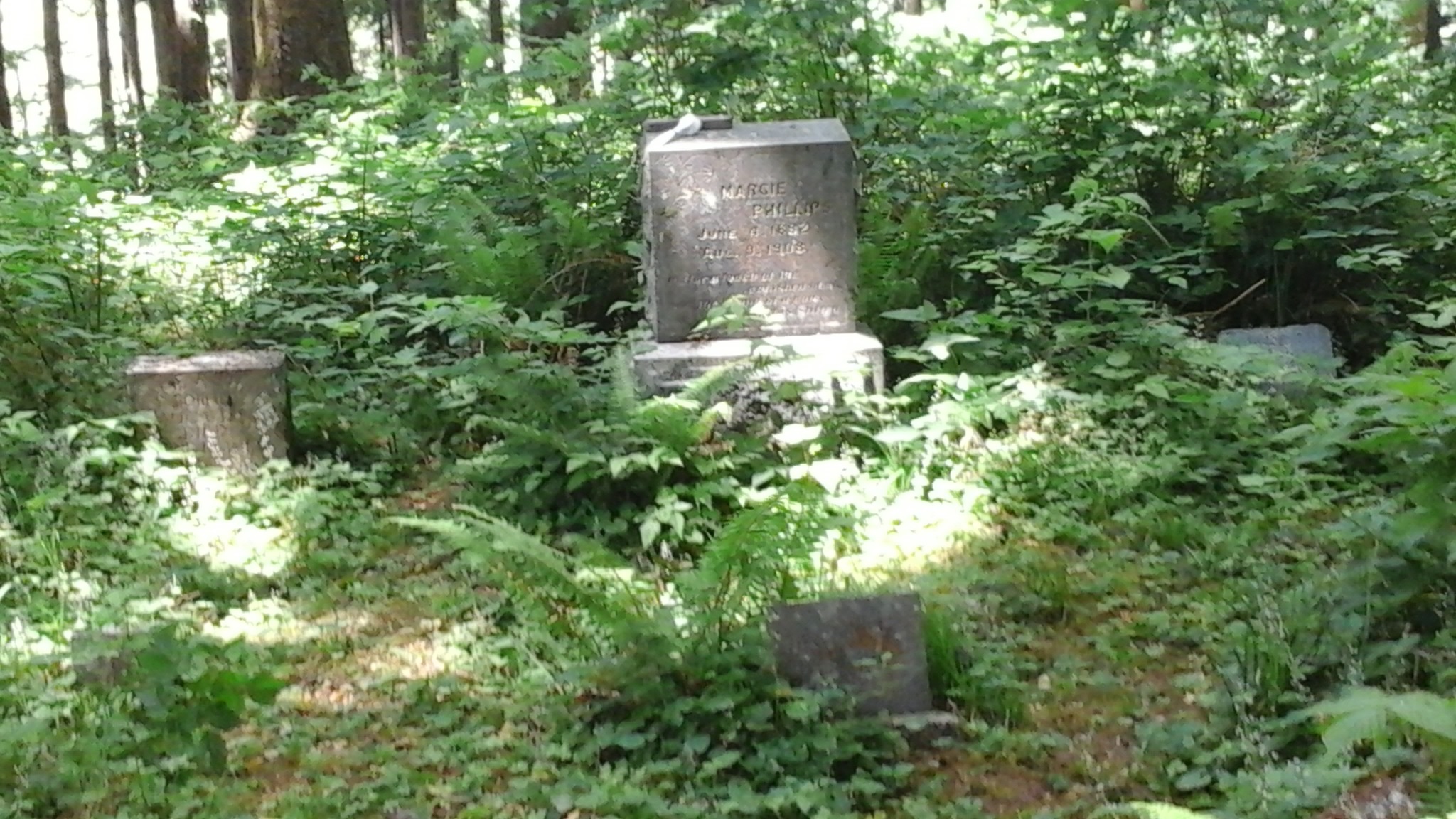
“The settlement of Markham didn’t have a place for a cemetery,” explains Meyer. “So they established one. The only way to get to it was by boat. People would go in on high tide, do the burial and have to wait until the tide came back in” to return to terra firma. Grave markers date back to the 1880s and represent some of the original Markham homesteaders.

Meyer also says there’s a monument in the cemetery commemorating locals who died in the flu epidemic in the World War I. In October of 1918, all public places on the Harbor closed due to an influenza epidemic. (We were unable to locate the monument during a recent hike to the cemetery, possibly due to dense undergrowth.)
It’s about a two-mile hike to the cemetery. The trail, which is on the east side of the river, meanders along a graveled road that’s mostly level and well-shaded. The cemetery itself is easy to miss. It’s vaguely marked by a weather-beaten sign that’s barely discernible. Sharp eyes and stout hearts will find the cemetery atop a quiet, secluded hill overlooking Johns River. A casual hiker can reach the site in about an hour.
Grays Harbor County Commissioner Frank Gordon says of the Johns River area, “It’s pretty neat and gorgeous.” The area is located in Commissioner Gordon’s district. (See map.) Commenting on the cemetery he says, “It’s a really special place to me. I can go in there and almost touch the people who are buried there. It’s the most beautiful view on the whole coast.”
The area is also rich in wildlife viewing and recreational opportunities. According to Commissioner Gordon, “Just before dark you can see hawks out hunting in the big open grassland. There’s also a family of mink that sneaks around during high water trying to catch ducks.” Gordon explains that the long-term goal of the Department of Fish and Wildlife is to “breach the dikes and restore the flood plain. Right now, fish are coming down in a straight shot down to the bay.” The flood plain restoration, he says, will increase the salmon, bird, and duck population.
Cathy Corkery agrees that the area is a hidden gem. Corkey is a Health Educator with the Grays Harbor Department of Public Health and Social Services. She says the dike trail “is definitely one of those secret gems in Grays Harbor. It’s kind of a dual-purpose trail. It provides opportunities for recreation and for seeing wildlife as well as birding, hunting, and fishing.”
Corkery notes that the dike trail is marked on Grays Harbor Tourism’s hiking and walking map. It will also appear on a new biking map. The dike trail is also listed under Connect Grays Harbor.
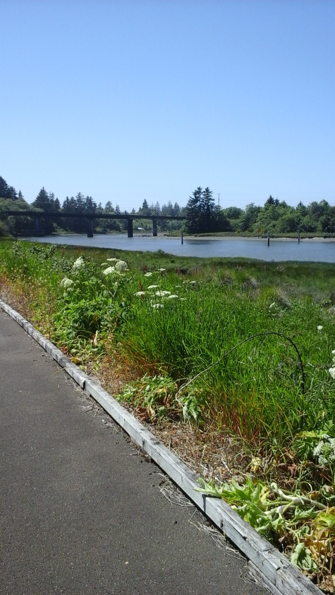
Indeed, hiking and wildlife watching are common on the dikes and established trail system. Located off Highway 105 and Game Farm Road, the Johns River Dike Trail is a paved, flat trail of .57 miles, one way. The area teems with wildlife, including Roosevelt elks, waterfowl, black-tailed deer, black bear, coyote, bobcat, muskrat and rabbits. The trail is limited to pedestrian access. Use of unauthorized motor vehicles, motorcycles, dirt bikes and skate boards is prohibited.
A photo blind can be found at the end of the paved trail for bird and elk viewing. An accessible ramp for boarding horses and boats on trailers is also available. To get there; take an immediate left after crossing the John’s river bridge when headed from Aberdeen. Turn left on Game Farm Road. Continue downhill towards the river. The parking lot is about 1/10 of a mile from the bridge. For more information on the Johns River Dike Trail, click here.
It takes a sharp pair of eyes to find the area’s two main access sites in Grays Harbor, particularly the cemetery trail site, which is unmarked. To access the site, head out of Aberdeen toward Westport on Highway 105. The undeveloped parking area at the trail head is on the left, just past the sign for Markham. It’s the next driveway past Dave’s Harbor Guns, about 10 miles from Westport. If you hit the Ocean Spray plant, you’ve gone too far. Stop for a restroom break before you access the area. There are no restrooms.
The Johns River Dike Trail is a little easier to find. Heading out of Aberdeen toward Westport on Highway 105, go past the Ocean Spray plant and up and over the bridge. Turn left on Johns River Road. It’s directly across from the blue John’s River Lodge. Veer left at the “Welcome to John’s River” sign onto Game Farm Road. Go down the hill at the Department of Fish and Wildlife/Public Fishing sign to the parking lot. Restrooms are available here.
Visitors need a Discover Pass.
You may have to look twice to find the twin gems of the Johns River Wildlife Area. But they’re worth the effort.
Additional sources:
The River Pioneers: The Early Days on Grays Harbor, by Edwin Van Syckle. Pacific Search Press and Friends of the Aberdeen Public Library, 1982.
They Came By Sea: Historic Grays Harbor Watercraft, by Ruth McCausland. Gorham Printing, Centralia, 2007.


